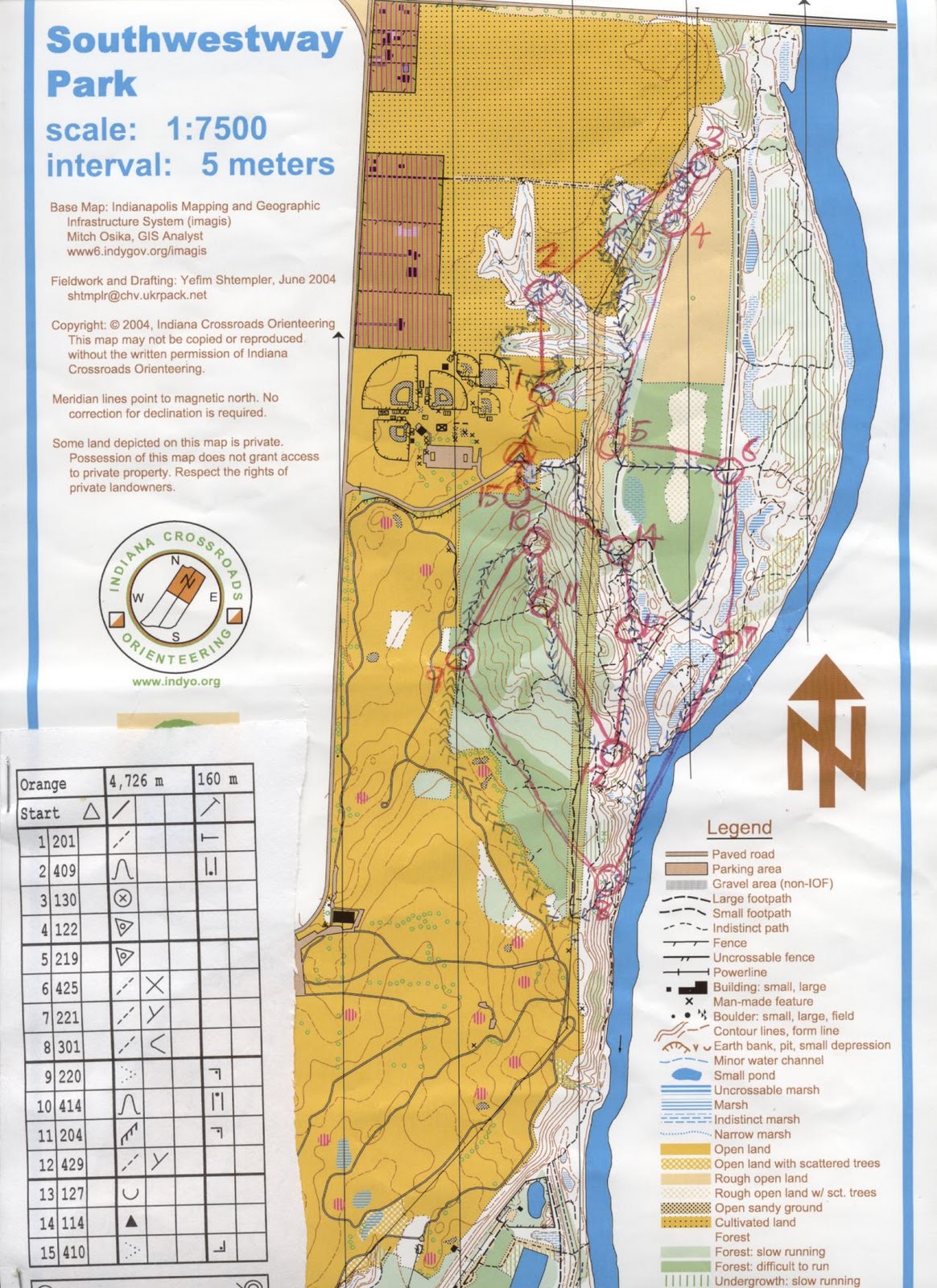
The format of this orienteering was a typical cross-country type, which means one has to visit the control points in the order that the map is specified. Since the park was small, there were only 3 courses offered: white (beginner), yellow (advanced beginner), and orange (intermediate). Note that in different countries, the colors of the course can mean different difficulties.
I had no split time for this orienteering, since only traditional punch was provided. Moreover, you may notice that the course was drawn by hand. In Indianapolis, most orienteering events did not have pre-marked maps. Therefore, there were maps on a table that have the course drawn. We had to copy the course information on an empty map that was given to us before we could start running.
It turned out that I did finish the course very quickly: I spent about 46 minutes to finish this course. I could follow the trail for the most of the course. Well, this may help me to train long-distance running. Moreover, in the beginning (control 1-3), there were major trails that were not marked on the map. This map was updated in 2004, so things in the park could be quite different in 6 years. Yet, I still followed the trail that was not marked. It turned out that the trail ran zigzag, but I managed to identify where I was at along the trail.
This map has quite a lot of open land (area with no trees). Such land is marked with yellow in color. Note that the southwest side of the map is actually a golf course. When I ran from control 8 to control 9, I saw some people playing golf. Fortunately, no golf balls were flying around that time.
About the color of the map, when I did orienteering in the first few times, I felt weird that the white color actually means forest that is easy for running fast. Isn’t that white means “there is nothing” in the usual color language?
Green did mean forest still, but how dark the green is relates to how thick the forest is. If the area is dark green, you cannot even walk into this forest because the wood is too thick.
Blue surely means water features. Rivers and marshes are marked on the map.
You may see the legend on the map to see how things are represented in an orienteering map.
Since this orienteering was done in the summer, the area was infested with mosquitoes. Fortunately, I covered the body with long sleeves clothing. The day was quite hot and humid, though, so there was a lot of sweating.
It looked like the organizers recognized our faces! Perhaps we had participate enough orienteering to be recognizable.
No comments:
Post a Comment