On March 27-29, I was with an undergrad, Alex to attend the
Flying Pig Orienteering Championship XIX in eastern Kentucky. This year’s
Flying Pig overlapped with spring break, so we can participate the full event. I tried to register as many the same courses as Alex, so that we could compare our results. It turned out that we could compare the sprint and middle courses. On March 26 (Thu), we drove 6 hours to Carter Caves State Resort Park, KY.
 |
| The Lodge, the event center where the internet was served |
On our first night, we went to the Lodge in this state park,
which was the event center where we could pick up the competition package. This
includes:
race bib:

model maps:
 |
| Carter Caves Model Map |
 |
| Morehead State Model Map |
…and course lengths:

We then camped there for three nights. It was so fortunate that we chose the coldest days to camp. On these nights, temperature dropped as low as 14F (-10C). This was weird given that the temperature last week was around 50F (10C). In the next morning (Friday), I took a picture of our campsite:

I also had some time to walk around the area, visiting some practice controls.
 |
| Control #66 on practice map |
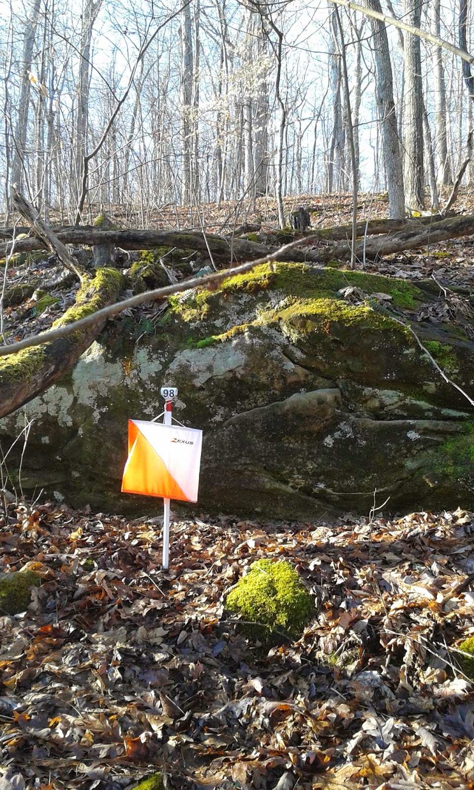 |
| Control #98 on practice map |
Friday Sprint
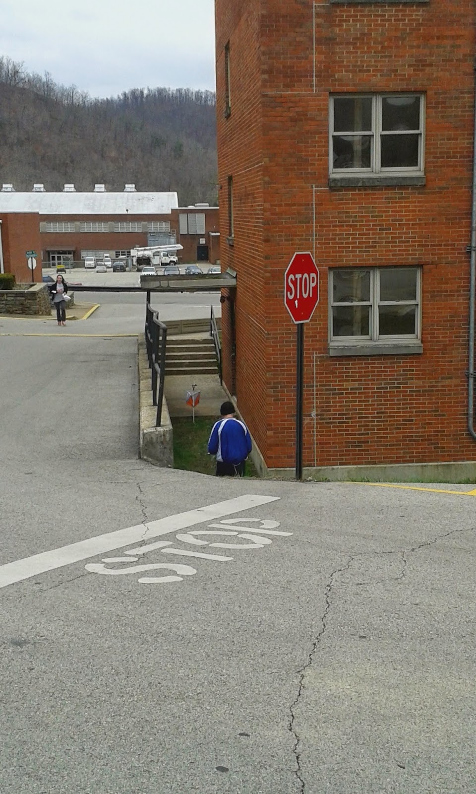
The sprint occurred in the afternoon at a small community college. I was assigned to start at 4:06 pm, which was not too early or too late.

I ran around a bit in the model map area because it was quite cold. A few flurries were dropping. This picture was taken at the furthest west of the model map area.

This was my time to report to the start. Once entering this area, there were still 3 minutes to wait. The start was behind the corner of the building.

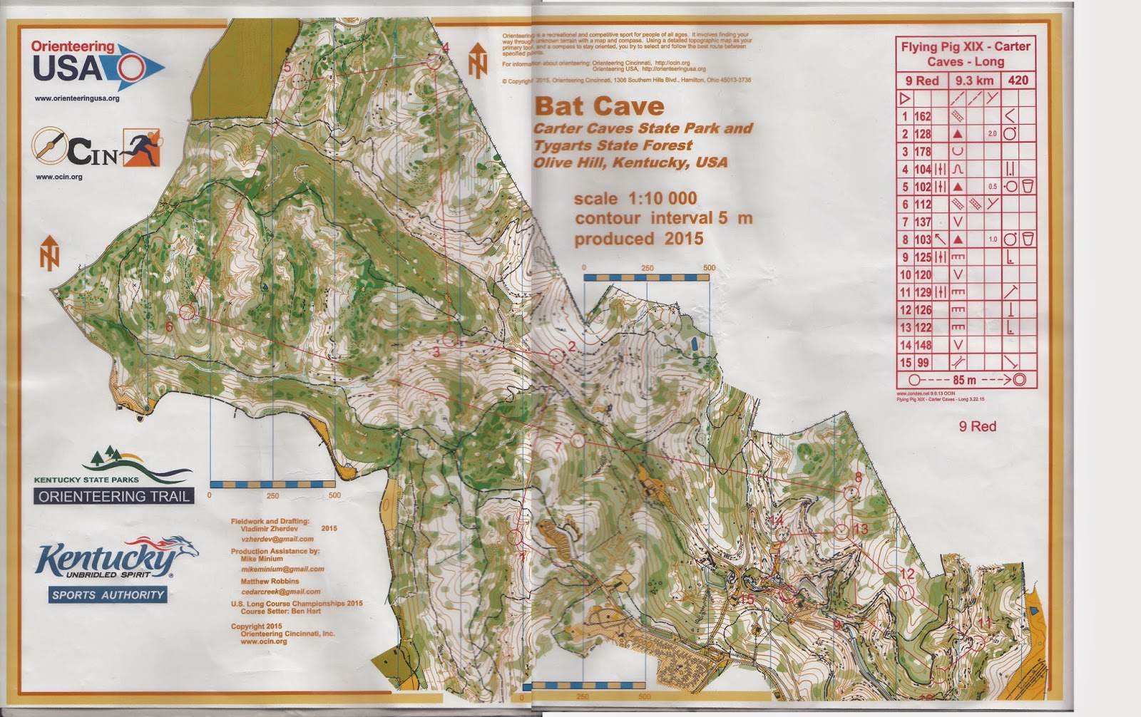
Here is the map:

...and here is my hand drawn route:

...and the result:

This sprint was quite long. Typically, I thought an official sprint race is between 2-3 km. Since, I was not that competitive, more distance was more fun for me.
The trickiest was probably #10-11, where you needed to read the impassable wall. I took the bait...
#13-14 was also quite tricky. I did not see the stairs to go down at first.
#15 was easy, but I read the wrong control number on the map, so I thought I was at the wrong place, but actually I was right.
#21-22: I used a less obvious way to run. I thought the way that I chose had less climb. Even though it might be longer, I could save some energy.
The following pictures were taken after the sprint:
Finish line:

Start line:

This was my control #26. This one made me hesitate a bit because I would like to find out whether it was on the second or first floor.

A control near my #5, which was on the other side of the road.
My control #2

Alex was a bit sad. He made a serious mistake towards the end. Still, comparing other controls, he was still slightly slower than me. He told me that he did not like sprint that much because there was no time to read map and no room for mistakes. Well, let's hope you will feel better when doing the next two courses in the next two days. They are longer.
When we got back to the Lodge of the Carter Caves State Park, it was snowing!

Saturday Long
I woke up from the tent, and walked to the start. The starts for long and middle courses were just few steps away.

Right outside my tent, somebody set up a fun course outside. In this fun course, you were given a map that only instructed you where to turn or not, and where to punch a control. The bearings in this map made no sense in this course. It was possible to punch a control multiple times, and ran on the same loop several times. From what I heard from Alex, if one made a mistake, the participant would likely need to restart.

You may look at the maps on the right, which shows how the instructions could be given.

.jpg)
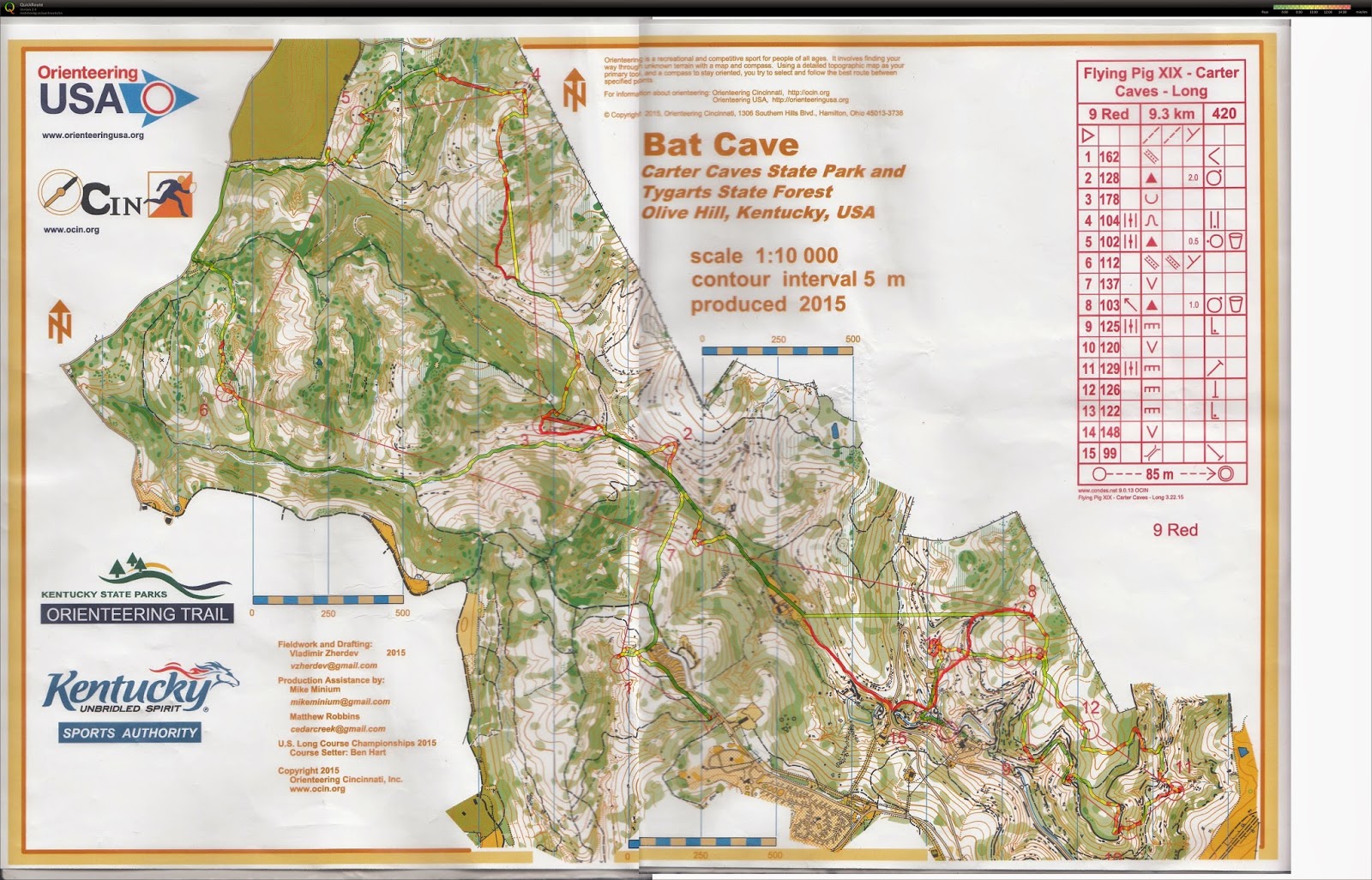
This is my GPS data combined with my hand drawn lines that described my route when my GPS was off.
%2Bmod.jpg)
and my time:
%2Bresult.jpg)
The course contained long legs in the first half, and middle-distance legs in the second half (I know that long legs will actually cover more than half of distance, but I classified the halves based on the nature of legs).
My routes to the first 4 controls were not the most optimal. In control #1, I overshot slightly to upper part of re-entrant. I guess I could get there 0:30 earlier without this mistake. In control #2, I did not need to go to the open area and went straight north to find the road. I also overshot a bit when I got close to #2. This was likely a 0:30 error. In control #3, I estimated a 1:00 error because I strayed off the trail too early to approach #3. In control #4, I thought of running to the next stream, heading north to the second stream branch, and going east to get to the control. However, I decided to use a more direct route with more climb. I made a wrong choice. When comparing to other people's results who use the stream route, they were about 1:00 faster than me.
Then, I felt I did fine in the following legs. In control #10, I went too far north, so it took me some time to find a little spot that I could drop down from the cliff. Look like I should simply use the route below the cliff. I thought the route might be slow because it was steep, but those who chose the below-the-cliff route was faster than me.

In control #14, I was baffled by the other control next to the rock. I kept seeing that other control, but I did not see mine. Where is my pit? This control just took me a while to carefully locate.

At the finish:

At the finish line, the organizer tried to put countries flags that represent the nationalities of all participants. I did know later that one flag was missing. Why? I will explain below.

A few hours later, when the organizer was packing, I asked the organizer if I could walk back to the long course area to take some pictures. He said yes, so I went back to my control #14 to take a picture, the control that gave me trouble.

For the rest of the afternoon, I walked around other areas in the park. First, let's look at this part of the map, which was near the finish:


Next, let's look at an excerpt of the practice map area. Notice the thick black oval that represents the cliff:

At the actual location, it looks like this:

This picture shows the thick black oval:

This picture was taken from inside the cave:

In the evening, Alex and I went to the dinner with the orienteers from Chicago. After we got back to the Carter Caves, David gave me a medal. I really did not expect I would get this!

What was going on was that there were only 3 people registered as M-Red. I was the fastest among three, so I got a gold medal. Hurray!
When checking the results in the red course, I noticed a Japanese name that was at the first place. Since getting an overall first place in such event is not easy, I checked if he was famous in orienteering. He is! His name is Hiroyuki Kato, who was at first place in AsOC 2010 sprint. Perhaps I should check with him on Sunday.
Sunday Middle
On the last day, I packed my tent first. Then, I still had hours to wait for the start for the middle-distance. I was assigned almost the last person to start.
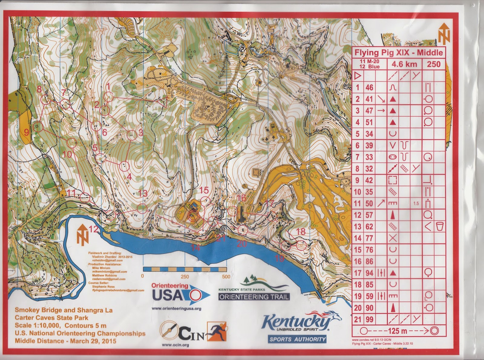
Here is the map for middle-distance:
On the last day, I packed my tent first. Then, I still had hours to wait for the start for the middle-distance. I was assigned almost the last person to start.
Here is the map for middle-distance:
.jpg)
My GPS data:
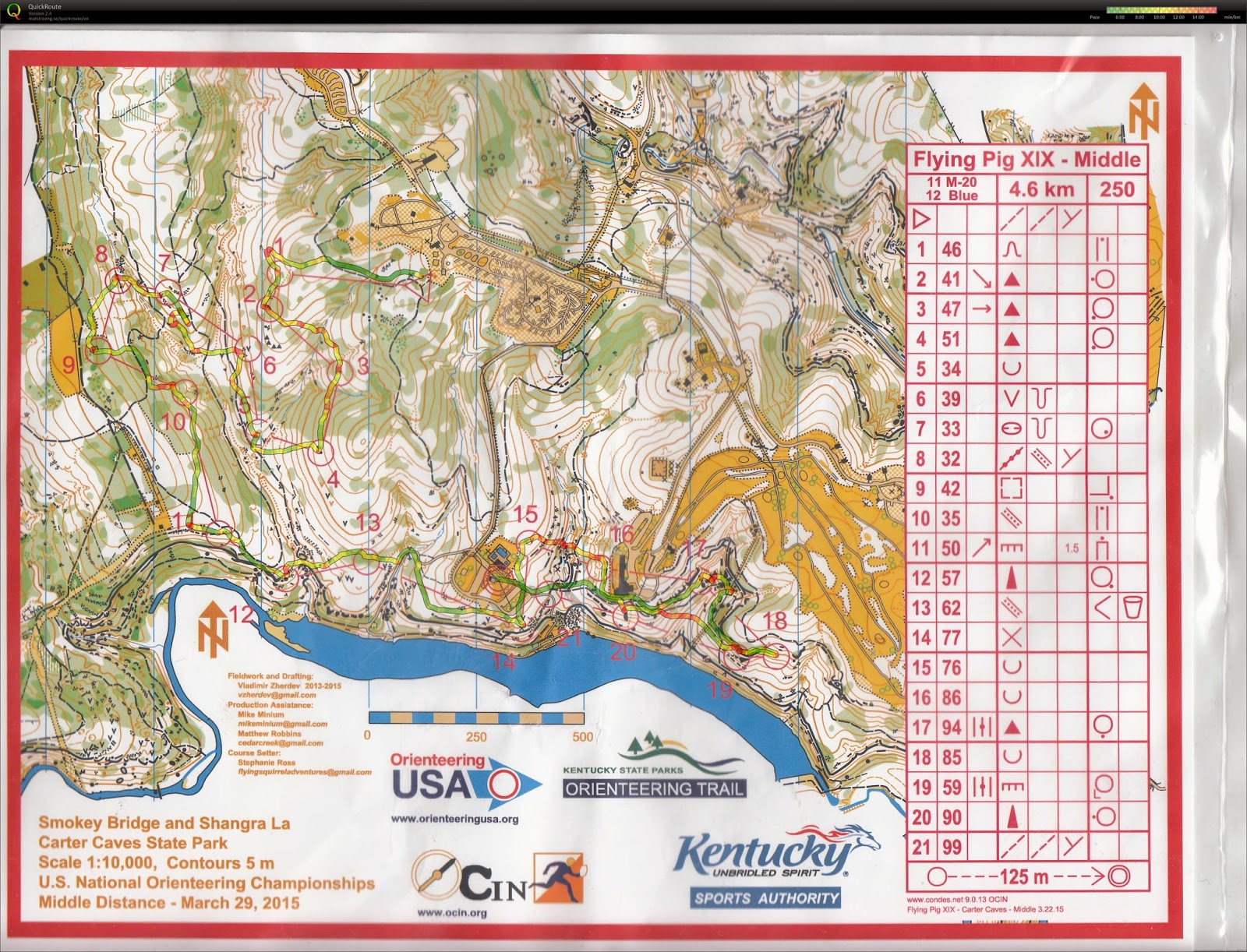.jpg)
My splits:
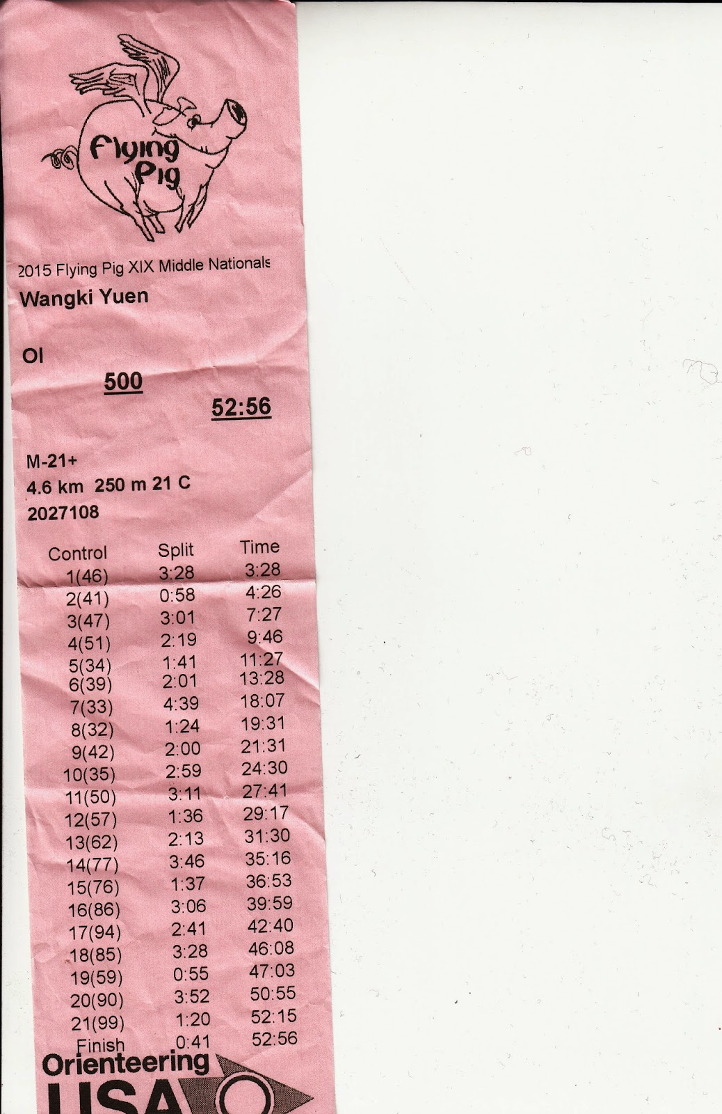%2Bresult.jpg)
Alex almost beat me for this course. He did better than me in the first 14 controls. I knew that my run was not that smooth in the beginning.
At the finish, I did find Hiroyuki. We talked a bit and he did know some of the Hong Kong orienteering competitors. We took a picture together.

The finish line looked similar to the long course. A Japanese flag was missing!

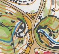
Now, let me show you this excerpt of the middle map. Do you see the grey area? That is the tunnel where competitors can pass through. The path on the grey area is above the tunnel.

Control #16 (see map above):

This is the tunnel:

Control #21 (last control, see above map)

Below are other views of the tunnel:


Acknowledgements
Thank you for the SORF funding provided by UIUC to financially support our participation of this competition. We gain valuable experience in competing against top orienteers in the world.