Friday, March 31, 2017

Performance statistics in orienteering

(Disclaimer: most of what I write is personal opinion. There are probably people who know more about orienteering performance statistics. I just write based on what I know about orienteering, and how it can connect to these statistics)

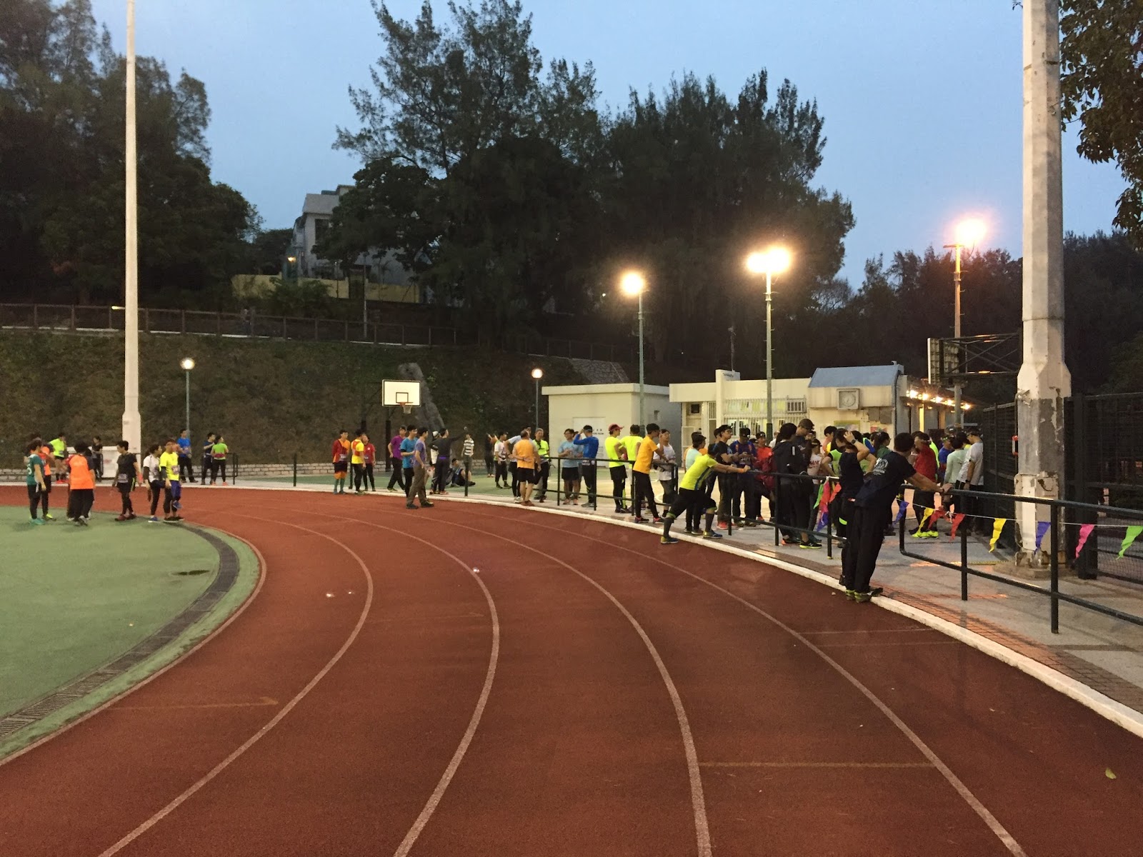
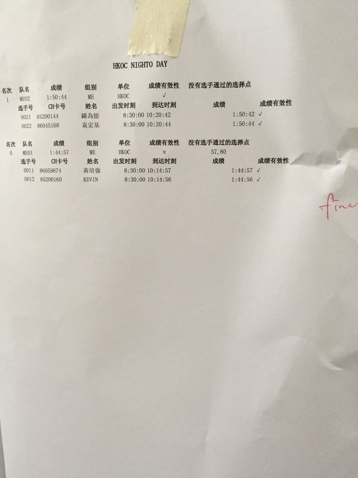
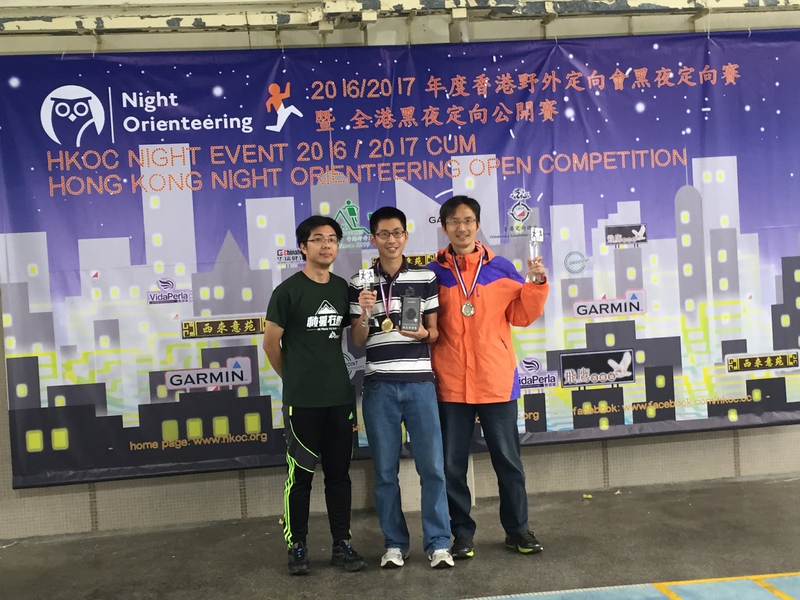
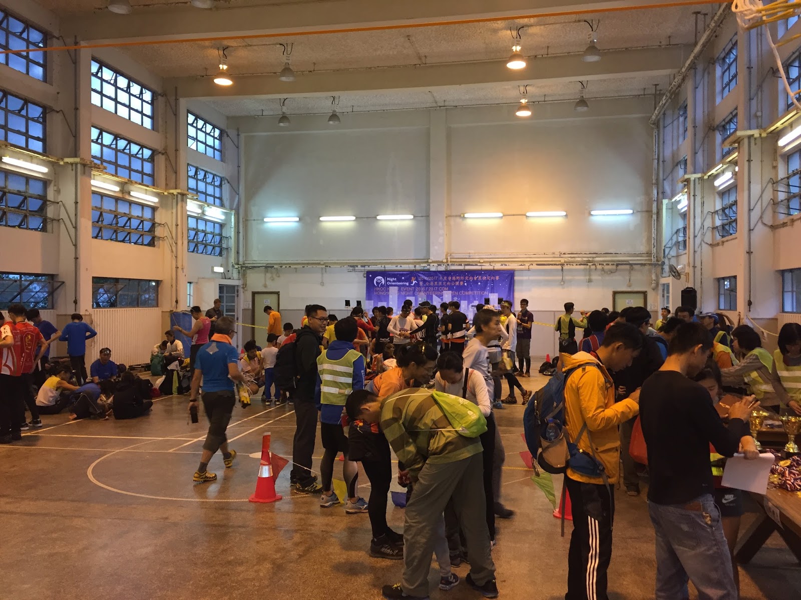
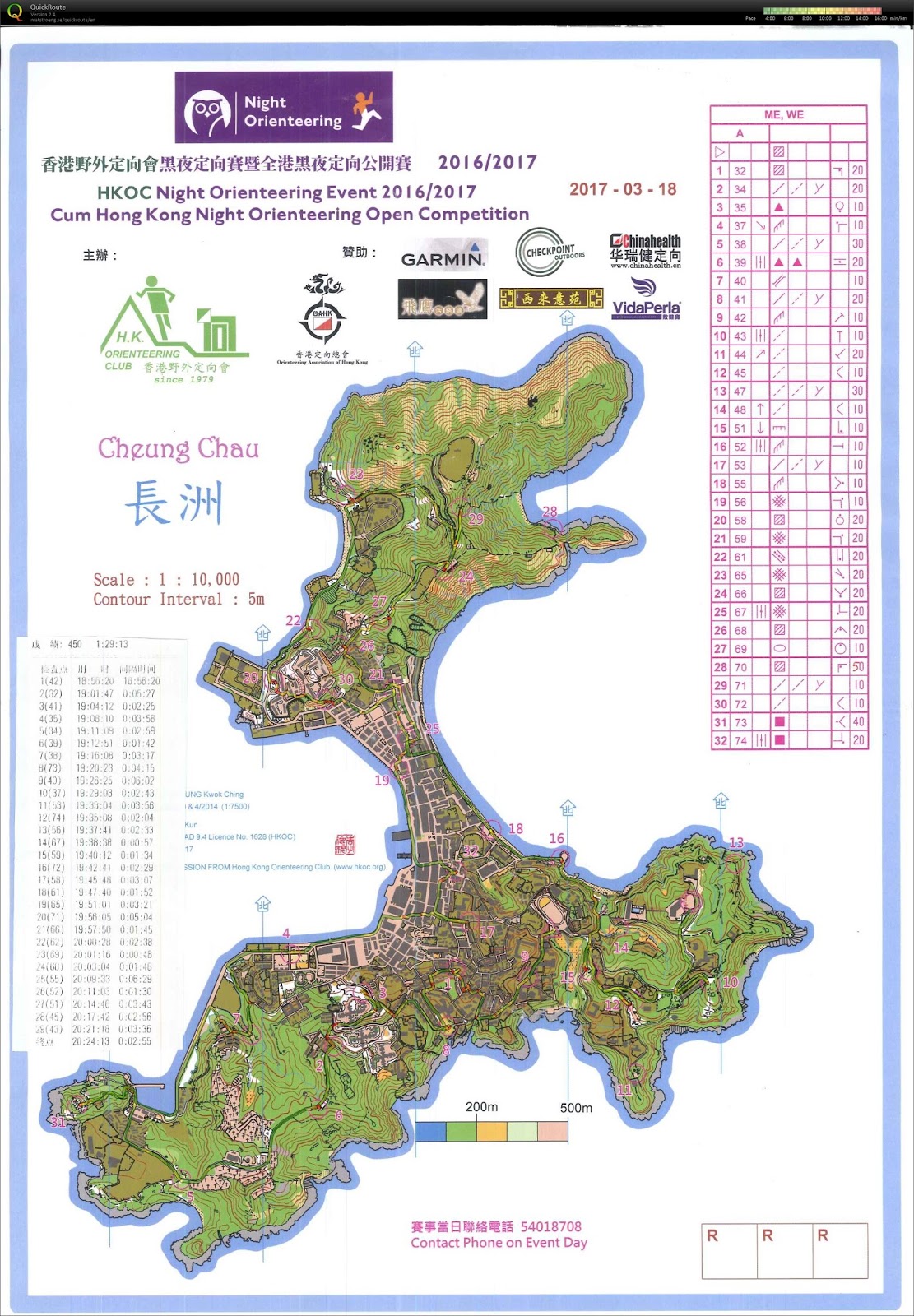
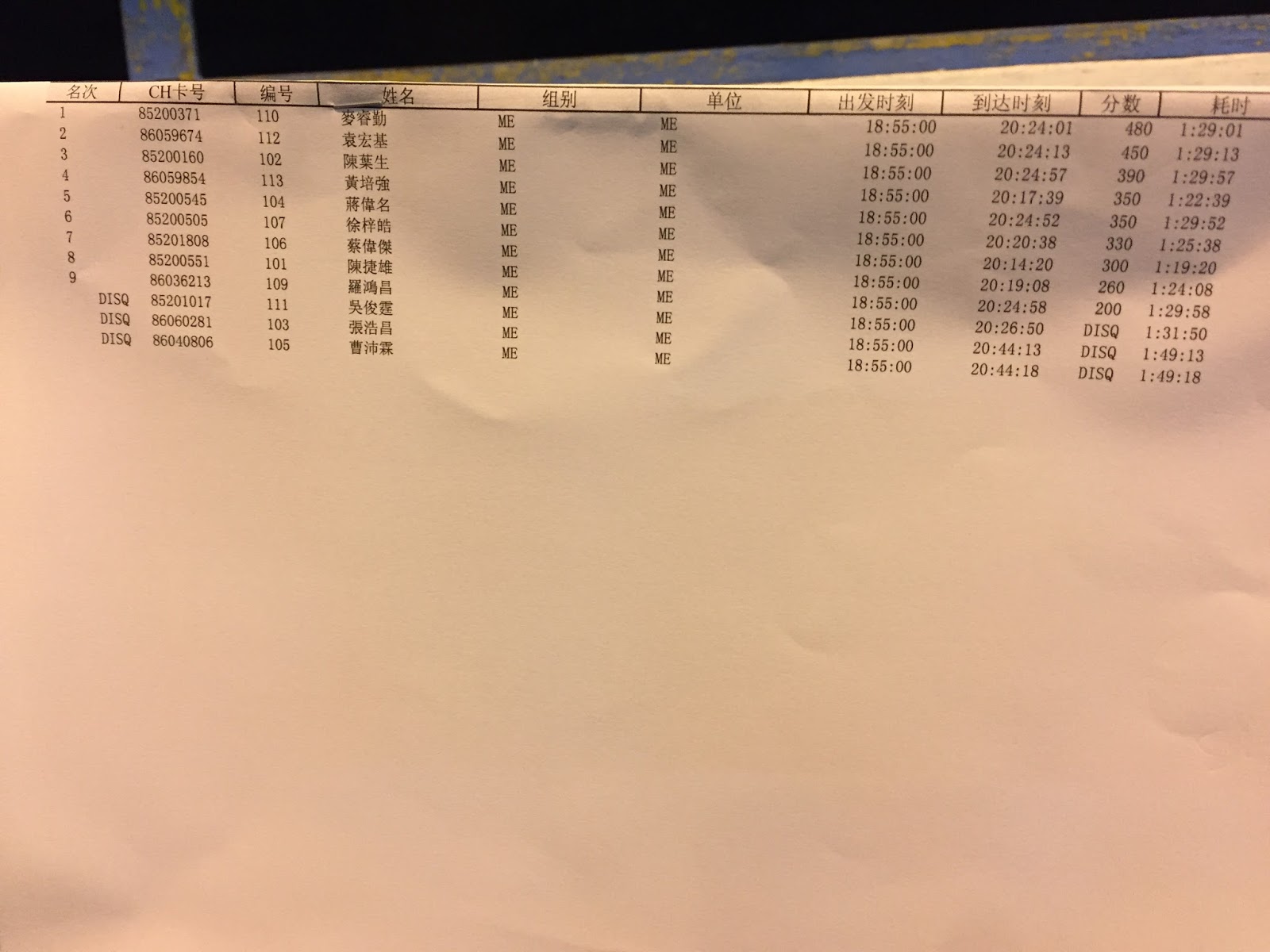
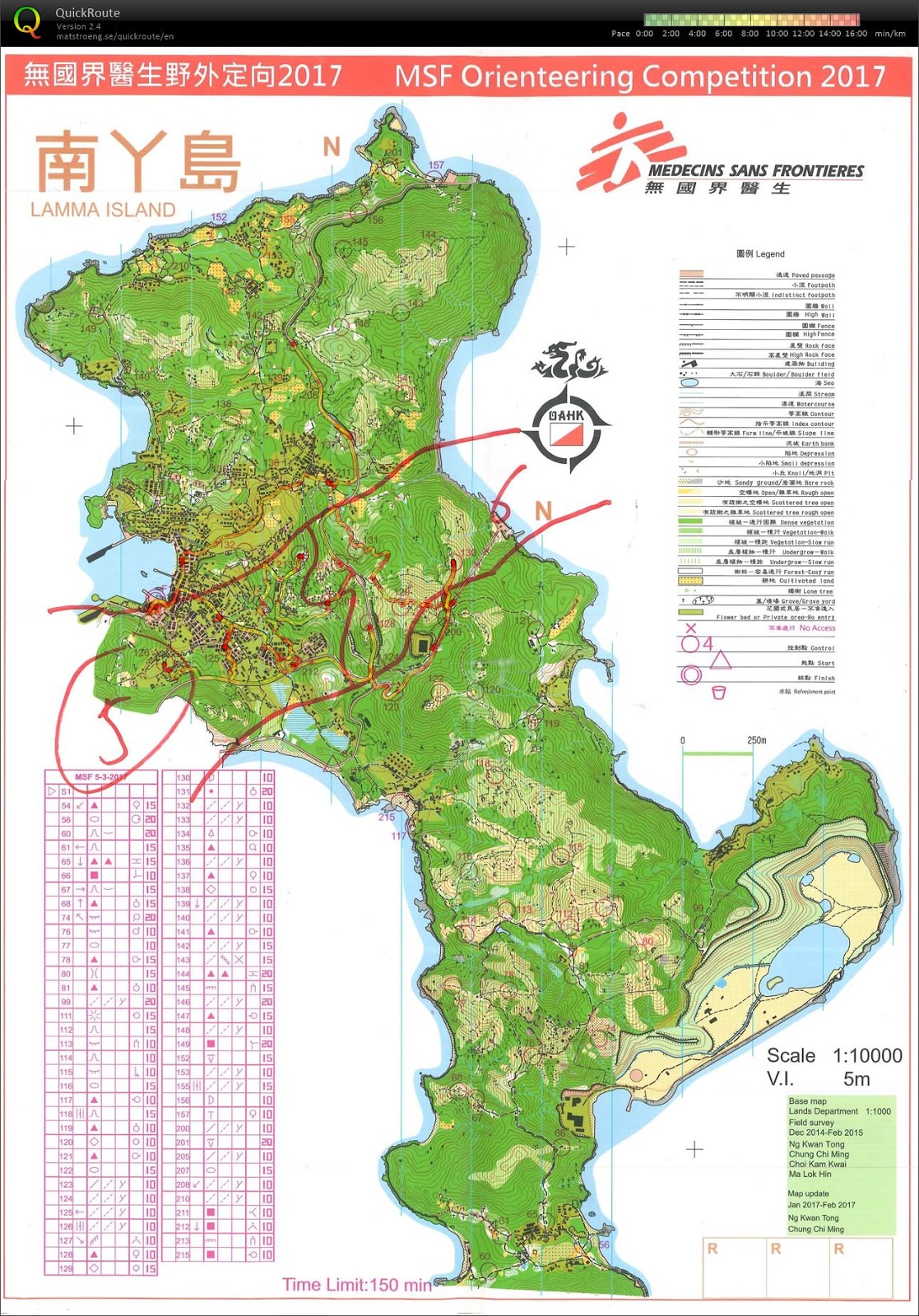
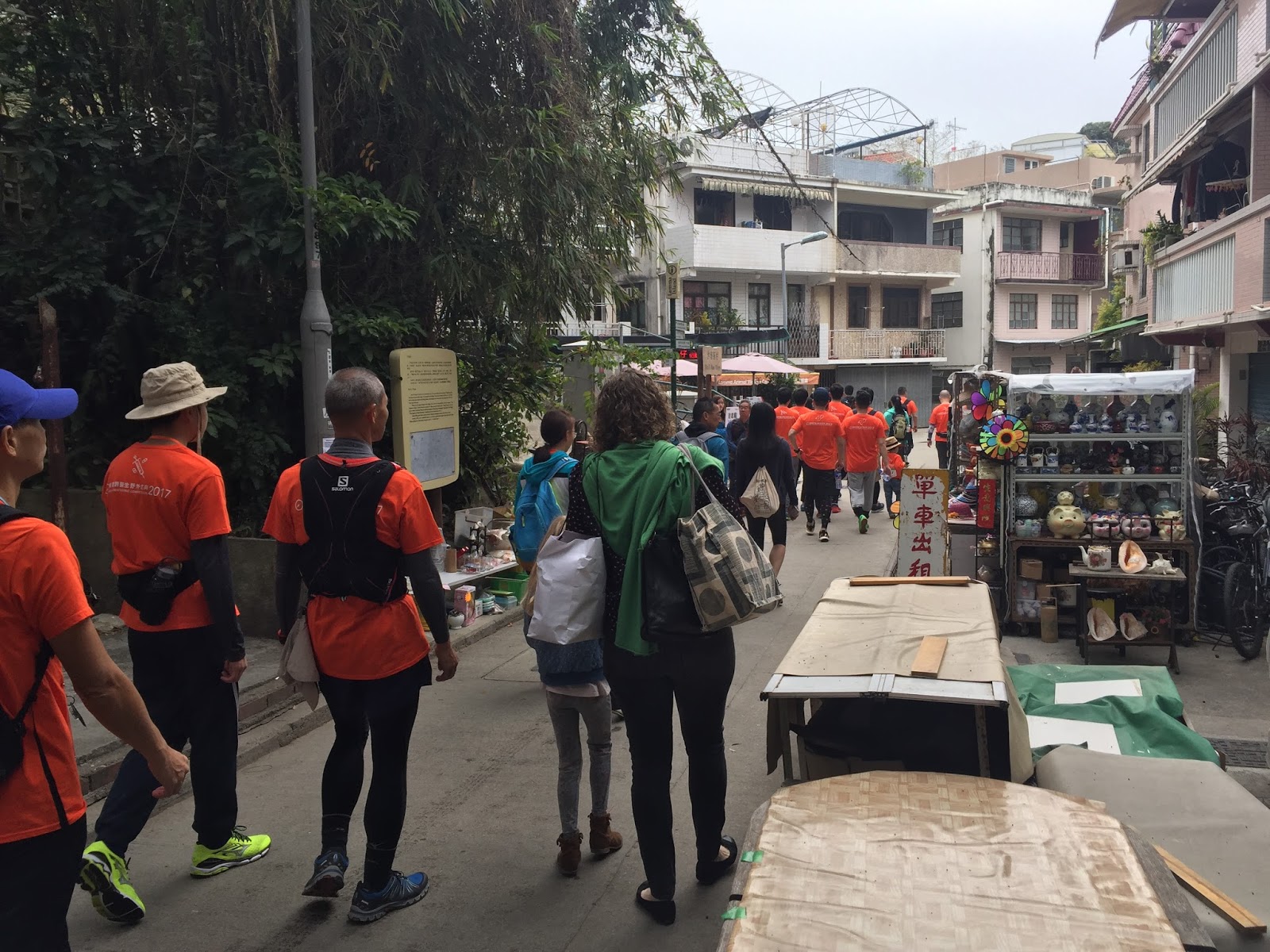
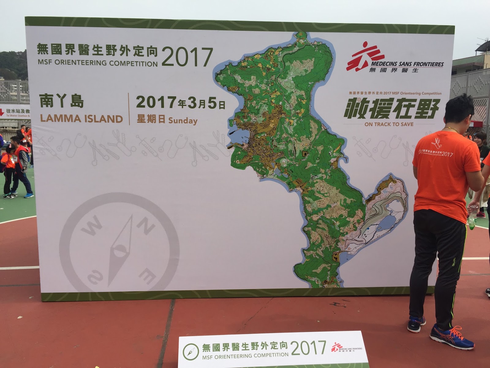
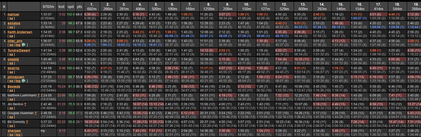
I was slow (88.7% from the fastest), and I made a lot of errors (~11 min total). From the race result last year in AttackPoint.
For those who have not heard of orienteering before, it is a sport where competitors need to find the checkpoints (controls) on a map as fast as they can. In the most common cross-country format, the map contains a list of checkpoints, and the competitors need to find them in a specified order.


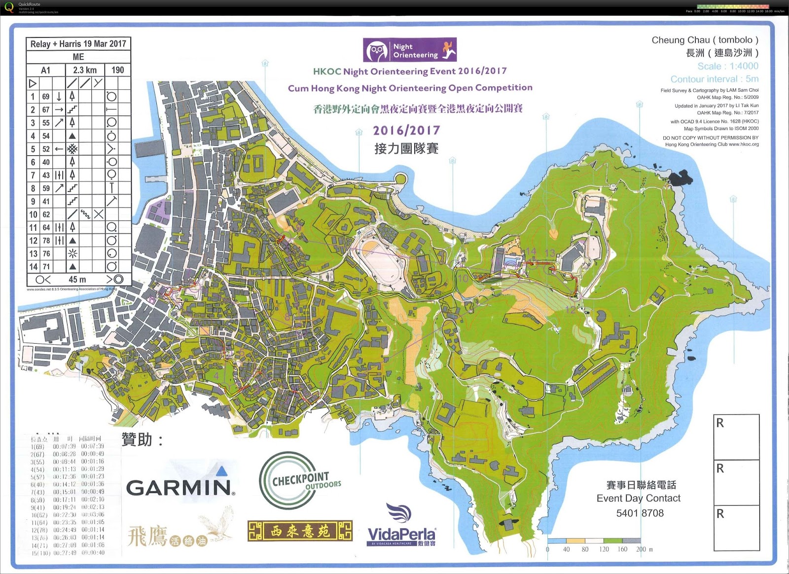
Before the age of computers, probably the only metric that assesses the performance of a cross-country orienteer is the finish time. To check if a person reaches all the checkpoints, punch card was used. Now, there is e-punch system to record the split between checkpoints (i.e. legs), and orienteers can compare each other on the performance of each leg.

Why Performance Statistics in Orienteering?

If a person wants to explore more on getting better in orienteering, he/she will eventually think, "how can I improve my time?" The classical wisdom of orienteering is that while speed is important for a win, if one gets lost while running fast, the time lost is usually more than running slow but gets the checkpoint location right. Thus, when orienteers want to get better time in orienteering, they needs to navigate to checkpoints as perfectly as possible (i.e. reduce error), while trying to maintain high running speed.

Unfortunately, merely having the split time does not clearly describe whether the loss of time is due to consistent low speed, or due to getting hopelessly lost in one leg but doing fine in the other legs. To find out this, some people try to separate split results into these two types, by comparing the results of other competitors and using some simple statistical methods. The advantage of separating these two types is that one can quantify how fast he/she is, and how many minutes he/she gets lost in a leg. To some people with science background (like me), simply saying "I am too slow" is not enough. Comparing to peers, how slow am I? Am I 10 or 20 minutes slower? For making error, instead of saying "I make a big error", I would rather want to say "I make a 10-minute error". With the statistics separated, I can also say whether I should focus more on making less mistakes, or I should focus on increase my average speed.

Thus, some orienteering result management tools can do further split analysis, mainly for separating individual errors from average speed. An example of the method is as follows:

Sakurai-Tori O-Lap analysis method

The method does not need GPS data, since split times of all competitors are enough for this method. However, it is always important to know the limitations for this simple method, since there are a list of assumptions in performing such calculations. You may read the link above to find out the details of the method, but I will mention the general approach of the method below.

Metric for Speed

After a race, an orienteer would probably like to know if mistakes are not made, how fast he/she can be. Such speed is best described by the speed relative to the top competitor's speed. The reason is that each leg has different physical and mental demand: short legs to test navigation, while long legs to test route choice; some legs may need to go uphills, while others go down.

When one can rate an orienteer's relative speed, a slow runner can evaluate whether his/her slower time is due to errors, or simply because he/she is slow on average.

It is important to state that speed does not simply mean how fast a person can run. It also includes consistent errors. e.g. if one orienteer always stops at every junction to decide which way to go, this counts as speed issue because he/she slows down by the same error all the time. Thus, if one finds his/her speed is much slower relative to the top performer, he/she should ask questions like:

1) Can I run faster?
2) Can I reduce the time stopped for reading maps?

Metric for Error

In contrast of speed, error here means abnormally lower speed due to inconsistent performance. This may be due to the following:

1) Getting lost in a leg
2) Choosing a less efficient route for a long leg

Before finding this error time, we need to know what the time will be when no errors are made. The challenge is that how the split times decide the ideal finish time, without a mistake. This should also take each person's relative speed into factor, since a slow person has slower time because of speed, and not necessarily because of error. In the cited method above, several assumptions were made for the calculation of ideal finish time for each person.

Once the ideal time is calculated, the error time is just the difference between the ideal time and the actual finish time. The error ratio can also be calculated by dividing the error time by the finish time.

The Tradeoff Between Speed and Error

It is incorrect to look and speed and error individually in orienteering, since these two interact with each other. When someone wants to improve the time to finish an orienteering course, he/she may want to run faster, but running faster will cause errors to be made more easily, since he/she is more likely to be tired and cannot think about the map clearly. It is stupid to just train to reduce the error ratio without looking at the speed, since he/she can walk the whole course and make no errors, but he/she cannot win!

I guess while the speed and error metrics do not exactly pinpoint what orienteering skills a person should focus on, these metrics provide a general direction. If I see my relative speed is too slow, I will try to run faster next time and see if my error ratio increases. If not, I should continue to increase the speed until I see my error ratio increases. Then, I can focus more on efficient map reading skills to see if I can spend less time thinking about map, allowing me to maintain the running speed.

Example: Comparing Route Choice


In a long leg, each orienteer may have a different route to get to the same checkpoint far away. At the end of the race, people may want to compare which route is the best. The two people with different routes may compare the split time to each other. However, we need to know if the two people have similar speeds before the comparison can actually be done. By looking at the relative speed statistics among orienteers, one can have a rough idea who runs similar speeds, whose split times can be directly compared. If a person wants to compare with the top runner's route, some handicapped time adjustment needs to be done before comparison.

One may also look at the error time. If someone feels that he/she does not get lost anywhere in the long leg, but get an error time, it is likely that the route choice is not optimal. He/she may even be able to estimate the time lost for that route choice.

Conclusion

Performance statistics in orienteering, inferred by split time, give us a rough idea on what area an orienteer should improve on. Combined with your personal experience during the race and the comparison of experiences with others, these statistics can roughly identify what skills should be improved, and quantify how good or bad (e.g. this is a 2-minute error). However, since these statistics are calculated based on a list of assumptions, it is important to not treat these data to be very accurate. If one has an ideal finish time of 20:00 in a sprint, while another person has an ideal finish time of 20:05, their speeds are likely to be not significantly different.

As a reminder, these statistics are just grades in your report card that give you direction for your future training. Reading these statistics alone does not make you a better orienteer. If you want to know how to train yourself, please ask other experienced orienteers.

Thursday, March 23, 2017

Two-day orienteering event in Cheung Chau (3-19-2017) - Part 2: Team relay and Harris competition

(Part 1 of the 2017 orienteering in Cheung Chau can be found here)

I woke up and walked around this Ming Fai Camp, which is on the top of a small hill. When I was young, I found this place pretty huge. Now, I did not quite remember how the camp looked like. It seemed to me that the building was extended. The interior was definitely furnished differently.


This is the playing field, where the finish of the last night's night-O was located.


At 7:35 am, I proceeded to the event center of Oi Fai Camp to prepare for the team competition. Look like the organizer will put checkpoints near Ming Fai Camp, so all participants need to leave the Ming Fai Camp area by 8 am.

Relay-Harris-O

When I registered for this race, I signed up for the team competition but without a partner. The registration said that the organizer would pair up the singles for the team competition. Last night after the night-score-O, some of us asked if teaming up has been arranged. At first, some officials appeared not to know that some participants register the team competition alone. Later in the evening, the singles were arranged to be paired up. When all the singles for the team competition were brought together, I saw someone that I knew from previous orienteering races. We checked about each other's lives. Then, we became a team.


He said there was a overall performance prize that combined the result from the night-score-O last night and the team competition today. He would help me to finish the race without disqualification to get this prize. Why does a qualified result is enough? There were only 2 teams, including our team, in the ME (male elite) group.

There were several ways to be disqualified in the team competition, and this can be easy to happen. Let's talk about how the daytime team competition works.

Competition format

Using technical terms, the team competition is a 2-person relay, and then a 2-person Harris competition.

Specifically, a relay means each person does a point-to-point course one after another. In other words, team member 1 gets a map with some number of checkpoints, all need to be visited in a specific order. Once team member 1 finishes, team member 2 will get a different course map, again with some number of checkpoints that need to be finished in some order.

Once both members finish their point-to-point courses, the race immediately gets into Harris stage. In the Harris stage, a few checkpoints are compulsory, and many are free checkpoints. Compulsory checkpoints need to be punched by all members in the specified order. Free checkpoints only need to be visited by one person, and can be punched within any segments of the compulsory checkpoints in any order (including start to compulsory #1 and last compulsory point to finish). The following diagram is an illustration.


There are several ways to get disqualified: 1) any person misses any checkpoints of the respective relay course, 2) any person overtimes (1 hour for each relay course), 3) any team missing any compulsory and free checkpoints in the Harris course.

Before the race started, the race officials explained the rundown of the competition, especially on what participants had to do when they finished their course segments.


The race was a mass start for all teams. Teams of different groups got different maps.


Teammate #1 was ready to go:


... and go!


Technical analysis

After my partner left, I waited in a designated area. I knew that for the ME course, each relay segment is ~ 2.3 km. I bet top finishers could finish such segment in 15-20 minutes. However, after 30 minutes, my partner still had not come back. Around this time, the other team already passed through a spectator checkpoint (a checkpoint meant for the partner to know his/her course is almost done), and finished the course segment 5 minutes after.

Fortunately, I saw my partner passing through the spectator checkpoint right after that. He later told me a mistake that cost him a lot of time.

When he finished the course, I could start with the following map:


The course was focused on the village south of the island. Although those alleyways can be confusing, I found pretty smooth in visiting the checkpoints within this area. I could plan 2-3 checkpoints ahead, so when I reached a checkpoint, I immediately knew which way to exit. The only concern was the dogs around, where I switched from running to walking.

After passing through the spectator checkpoint (#11), there were a few more checkpoints at Ming Fai Camp. They were not too difficult, but it was quite a bit of uphill and downhill. When I finished my segment, it took me ~ 23 minutes. I felt pretty good because I did not feel like I made any major mistakes (i.e. getting disoriented).

Now my partner and I each got a Harris course map. As this was my first time to do a Harris course, we discussed at the start for >8 minutes to distribute who got which free checkpoints. I felt this planning time was too long, but during the discussion, we almost missed seeing the free checkpoint #57. Thus, we became more careful to make sure no free checkpoints were missed when planning. We even used a pen to check off the free checkpoints.


The final plan was the following:

Me: 63-58(#1)-50-39(#2)-36-42(#3)-57-53-60-65-74-79-82-81(#4)-75-finish
My partner: 58(#1)-48-47-44-39(#2)-38-42(#3)-51-45-46-72-80-81(#4)-finish

We distributed the checkpoints based on the shortest two paths that traveled between compulsory checkpoints. For example, #50 went to the beach, while #48-47-44 went into the interior. This increased the planning time, but the resulting route will be more optimal.

The execution of the plan was fine. However, when I visited #57, I kept feeling that I might have missed a checkpoint. I walked and read the map, double checking whether I missed any checkpoints on my side. Then, I found that I punched #38, not #36. My mind must have mixed up, convincing myself to get my partner's checkpoint. To not get disqualified, I wasted 7-8 minutes of time to run back to #36, and then returned to #53. It was a long way back and forth.

I could handle the rest of the course. I just felt sorry that I almost ignored a checkpoint that I had to punch.

After the race, I learned that some teams grouped one area of checkpoints for one person, and another area of checkpoints for the other person. This can shorten the planning time. After my mishap, we should probably let one person get both #36 and #38. However, for the rest of the course, I felt that planning two routes between the compulsory points make more sense.

Award

As expected, when I got back to the finish, my partner waited for me. The time when the slower person punches the finish is counted as the finish time. After finish, he told me that he waited about 5 minutes for me. I told him the mishap.

At the event center, our team found that the other ME team was disqualified because they did not punch #57 and #80. Thus, if we punch all the checkpoints properly, we win.

We did.


Thus, our team won because there were only two teams competing and because we were more careful in completing the course. My partner told me that when I got back to finish for the relay, the other team just passed through the spectator checkpoint. This may make them plan the Harris section in a rush and overlook some checkpoints on the map. My partner was even concerned if I punched all the checkpoints in my relay, since I came back so fast.

We got the skincare product, again for me.


There was also an overall performance award that was based on the combined results of the night-score-O and the relay-Harris-O. I, who particpated in both races and got placed, got the first place for the overall performance award. The prize was a Garmin Forerunner 630 GPS watch. This is a high-end GPS watch, and I like it, but I had my current Garmin GPS watch only a year ago. I probably will sell it to someone who needs such high-end GPS watch (note: I already have a potential buyer).


Post race

After the award ceremony, the rain got heavier outside. Nevertheless, my partner and I had lunch in the village center. I also bought some dessert, before leaving the island.

Back home, I had to take care of the awards: medals x3, skincare products x2, GPS watch x1, trophy x1, plus another trophy cup that will have my name engraved. I have never got so many awards in an orienteering event before!

This made me wonder: where were the true elites. I only saw a few familiar faces, and several of them were not in the elite group. I treat the awards that I got as participation awards.

(the end)


Wednesday, March 22, 2017

Two-day orienteering event in Cheung Chau (3-19-2017) - Part 1: Night-score-O

(Note: this is Part 1 of the orienteering report for Cheung Chau. Part 2 is here.)


About Cheung Chau

Cheung Chau brought me back a lot of childhood memories. When I was a kid, my parents often brought me to day camps or night camps here. I swam at the beaches there, and Cheung Po Tsai Cave always brought me excitement to walk into.

In a geography class during secondary school, the teacher talked about Cheung Chau as a tombolo -- an island formed by connecting two islands by a deposited sand bar. The natural deposition results in a dumbbell-shaped island.

Since I went to the US for my study, I had only been to this island once, and that was ~7 years ago. When I started being more serious about orienteering in these years in the US (at a point that I started a college club), I talked to Jan, a Czech guy, about the orienteering map of Cheung Chau and how nice a sprint orienteering place it can be.
Sprint orienteering: an short orienteering course (typically 1-3 km long, with winning time of 10-20 minutes) where quick decision and high-speed running are tested. Dense villages with confusing networks of paths are often difficult places for sprint orienteering.
Last week, I got an opportunity to run on this map. There were a night orienteering (night-O) on Saturday and a team orienteering on Sunday. Like many other orienteering races in Hong Kong, one needs to register a few weeks ago in order to participate.

On Saturday at 4:15 pm, I took the slow ferry to Cheung Chau, which takes about an hour (the fast ferry takes about 30 minutes).


The event center was where the childhood memory kicked in: Oi Fai Camp. which is at the middle of a small hill. Ming Fai Camp, which was where I would get a sleep, is located on the top of the same hill. The two camps are connected by a long stairway. It took about 20 minutes to walk to these camps from the ferry pier.

On the way, there were many lover's locks that looked like recent world phenomenon -- in many places around the world, someone likes to open up a space for the existence of locks.


I only came here for a geocache, but the cache was obviously stolen (aka muggled).


Walking slightly further, there is a famous sushi roll that costs HK$10-$40. I gave it a try, treating it as a pre-race meal.


Night-Score-O

In the event center of Oi Fai Camp, participants were getting ready to start. When I was there, it was already close to 6 pm. Some participants had already started. I would start in the latest group at 6:55 pm. Before starting, I needed to pick up my bib and the e-punch (the Chinahealth punch that works similarly to a SI punch). Then, I had to change my clothes. I found a person with a nickname 40,000 giving beginner clinic to some participants (actually, he gave directions to places most of the time).


It took about 5-10 minutes to walk to the start. This was a good place to warm up before the run.


Competition format

This was a night-score-O. In a score-O, each checkpoint (control) has a fixed point value. One can visit the checkpoints at any order (s)he wants, and one can skip checkpoints. The goal is to get as many points as possible within a time limit. In this race, 90 minutes were given. If two participants have the same points, who reaches the finish first wins. If someone overtimes, there is some kind of penalty. In this race, anyone finishes over 90 minutes would be disqualified.


This race was a mass start in batches. Participants within the same group started at the same time. Here, people were waiting to start.


One minute before they start, each participant was given the map, and they could plan how they visited each checkpoint. After a long beep, they could start.


 Before start, each person needs to bring a whistle, a compass, a e-punch, a headlamp, and a bib.

(provided by HKOC)

Technical analysis

The ME group (men elite) map is as follows. My route is also shown.


When I first looked at the map, I slowly found where the start (triangle) and the finish (double circle) are. Then, it took me a while to see the distribution of checkpoints. I only had a general approach: sweep the checkpoints on the SW side of the map first. Then, I go to the north if I have time. Finally, I leave some time to find the checkpoints close to the finish.

I was very slow in the first few checkpoints, since I had to adjust with seeing with the headlamp. Moreover, I was still deciding the optimal way to sweep the checkpoints on the SW side. The checkpoints for my earlier stage were located inside confusing alleyways. Thus, I almost stopped at every path junction.

Once I got to checkpoint #3 (35), the order for the rest of the SW checkpoints was pretty much set until checkpoint #4 (37). After leaving the village area, I could run pretty fast. I just needed to pass through a cemetery in the dark.

The 40 points for #31(73) were worth of my time. That one was so close to Cheung Po Tsai Cave.

After #4, slightly more than 30 minutes were passed (i.e. 1/3 of the given time). I did not plan as far ahead, seeing 2 to 3 checkpoints at a time. I was back to the village area, so I had to be careful not to get lost.

For the checkpoints in the north, the order was pretty much set, seeing that I had plenty of time to sweep them. The exception was the 50-point #28 (70). It was far. I needed to go down and climb back with almost 100 m elevation. I also had <30 minutes at that point. Why not just go near the finish and sweep the checkpoints there?

Later, I found that I should not find #21 (59) and #25 (67) on the way to the north. I should find them on the way back to the south.

When I reached the SE part of the map, there were only 10 minutes left. I forgot to pick up #14 (48), the one that was close to Oi Fai Camp. Then, I used to remaining to pick up the checkpoints with smaller values. I did not see that the two checkpoints (#11 (44) and #13 (47)) that I did not have time to pick had higher point values.

When passing the finish line at Ming Fai Camp, I had slightly <1 min to spare.

Overall, I felt quite good because I did not feel lost at anytime during the course. This feeling got better because I found many of these checkpoints in the dark. I gotta say that the reflective strips on the checkpoints were really reflective to my headlamp. Once I knew where the checkpoints were approximately located, I could see these reflection without any problems.

I skipped 4 points that were worth 110 points. I got a total of 450/560. I wondered if any elites could sweep the whole course (i.e. 560/560).

Award

I went back to the event center to print the results, pick up the key for lodging in Ming Fai Camp, and pick up a cup noodle (without a fork), a cake, and a carton of juice for tonight's dinner and tomorrow's breakfast (certainly not enough for me). Then, I looked at the preliminary results. Huh? Nobody got over 400 points? Even when the result was final, there were only 2 people got over 400 points, and I was one of them.


Where were the elites? I felt that the true elites could sweep the whole course except getting #28 (70). There were actually more people in the MO (man open, in pairs) and the MC (man challenge, single) groups to compete with than the ME group. I also knew some people in the MO group ran much faster than me.

I did know that some elites went to the north first and picked up #28 (70) for the 50 points. In their situation, it was less obvious that this point was not worth of the time.

Anyway, this was the first time that I got into the first 3 places in an orienteering that needs running (i.e. not trail-O). Let's see what I would get.


As a second place, I did not only get a medal, but I also got a cup and ... VG Cellumed - Swiss Skincare Product. Who would like to use it? I guess females are more likely to be interested in such products.


Intermission

I finished the cup noodles (using the straw from the drink as fork) and the drink before the award ceremony, but I was still hungry. I went back to the village and found only several dessert shops open. After getting dessert, I went to a store to buy a drink for tomorrow's breakfast.

I returned to Ming Fai Camp that I had not been for >10 years. The place seemed to look very different now. I remembered that the rooms were segregated by cutting one half of rooms for the guys and another half for the gals. Now, the rooms had no such distinctions.


Before sleeping, I thought about if I could optimize my route more to get more points. However, I could not think of any unless I could run faster.

(to be continued in Part 2...)

Saturday, March 11, 2017

Orienteering Report: MSF Orienteering 2017 - Lamma Island

MSF (Medicins Sans Frontieres, French for Doctors Without Borders) organizes orienteering events annually in Hong Kong, which probably attracts the most people to participate in such event. There were around 4,000 to 5,000 people to participate. Also as a fundraising event for this meaningful organization, each team needs to get sponsored to a minimum amount of money before the participation.

More information can be found at this link:
https://ssl.msf.hk/oc/home/en?#

From the orienteering perspective, this is a score-O event. In the MSF Orienteering, each team was given 2.5 hours to search for as many checkpoints (controls) as possible. Each checkpoint has a point value that is based usually on the difficulty to reach. The number and distribution of checkpoints are designed so that getting all checkpoints within 2.5 hours would be very difficult.

I was not a participant but a volunteer. I found on FB that the orienteering group in HK needed volunteers to set the checkpoints. As a person who has organized some orienteering events, I signed up immediately. Thus, I became part of this technical team to make sure the checkpoints were placed correctly. I did not even care that I had to be at the pier by 6:20 am.

To the event center

On Mar 5 at 6:20am, the sky was still dark, but there were already about 100 people waiting for the special schedule of ferry. All of these were volunteers. Some of these stayed at the event center. Others were in the competition area that do various tasks, such as guiding people to the start, guarding the water station, or providing first aid. All of the volunteers did not need to pay for the ferry.


It took about 30 minutes to get to Lamma Island. Time ran very fast because I met some people that I had not seen for a long time. These people were also very friendly. When getting to the island, I saw the iconic three stacks for the power plant that supplies electricity for HK Island.


Signs were pretty clear to get to the event center:


This was where the event center is. It was ~7 am, an hour before the actual event start time. Thus, the place was pretty empty.


Setting checkpoints

Once we got to the event center, items for the checkpoints were checked and grouped. The entire competition area was divided into 11 regions. Each region contains 6 to 7 checkpoints that were placed by a volunteer.


There were 68 checkpoints in the entire competition area. At each checkpoint, there was a SI e-punch with different checkpoint numbers. Before sending them out, they needed to be checked if they functioned properly.


Here were the items that I got for my region. There were orange-and-white orienteering marker bags, SI e-punches, backup mechanical punches (in case if the SI e-punches malfunctioned), and wooden fixtures that help connecting the e-punch to a stick.


Here is the map, with my GPS watch data on it. Sometimes I use the GPS data to see how accurate the map was drawn. I was responsible for the checkpoints in Region 5. These checkpoints were closest to the event center. Many of these points, in the maze-like village area, could be easy to be placed wrong if I did not read the map carefully. After placing all the checkpoints in Region 5, I needed to go to Region 6 to check if the person responsible for the Region 6 placed the checkpoints correctly.


The volunteers who placed checkpoints were then dispatched immediately. The first wave of participants would start at 9:30 am, and I had slightly more than 2 hours to set up and check the checkpoints. First, I set checkpoint #126: path junction:


 Along the way, I took a picture of the village from above.


Then, I put checkpoint #125: path junction. Going from #126 to #125 could have many ways to go wrong.


This is checkpoint #212: north outside corner of a building. At this point, I wondered if I should get some metal stick to fix the checkpoints on the ground, rather than tying them up. The wooden fixtures were meant to use with sticks.


Checkpoint #127: north outside corner of a fence. Some people were preparing to do physical training.


I began to leave the village. Here is checkpoint #213: top of a cliff. I used the stone surface to place the e-punch horizontally, rather than letting it hang vertically.


My last check point to place - checkpoint #208: path junction. I found a stick already inserted on the ground, so I made use of it.


Checking checkpoints

Setting the checkpoints took me almost an hour. After informing the course setting volunteers that my region is ready in Whatsapp (first time to find it so useful!), I went to check the checkpoints in Region 6. These checkpoints were more in the wilderness. For example, checkpoint #129 (open land, south edge) was almost at the top of a hill, where the Lamma Power Station could be seen.


Within 100 m, one could find this full view of a wind turbine.


At the bottom, there were exhibits showing information about this wind turbine. It boasted HK's attempt to generate renewable energy. I laughed at it. In the US, you could see thousands of this to form a wind farm, but in this island, this is the only one. The amount of power generated by this one turbine is too small. Thus, I feel that this wind turbine is more like a tourist attraction.


I also did some geocaching when checking the checkpoints in Region 6. In orienteering, checkpoints are found by reading a map. In geocaching, hidden containers are found by using a GPS. There are more than 1000 geocaches in HK, and millions around the world. Near the wind turbine, I used the GPS in my phone to find this cache container.


This is checkpoint #130: terrace. Another view of the wind turbine.

 
When I finished checking the checkpoints in Region 6, I could hear the horn far away. It was 9:30 am.

Event center

I was instructed to return to the event center to get some refreshments after checking the checkpoints. Along the way, participants were walking to the start.


Here was a volunteer holding a sign for direction.


At the event center, I found this huge finish line.


Beside the finish, there was result download.


So many people were in the event center now. They probably were waiting to start. There were many things they could do.


For example, you could get food. Each participant could have bananas, biscuits, and hard boiled eggs.


There were locations for group pictures.


Baggage storage. With thousands of people participating, the service was like running a marathon.


Water station

I was then told to go to the north water station to help. Participants were already forming lines to punch the checkpoints. This is a picture at checkpoint #211: west corner of a building.


Another picture of punching a checkpoint at checkpoint #137: south side of a boulder.


I finally arrived at the water station. As an orienteering event, the size of the water station was huge. There were three taps for people to refill, plus a mobile tap held by a person.


Participants came to the water station in waves, since the starts were in many waves.


 People could feel free to fill the water by themselves,...


...or we helped them.


These water users ranged from elite runners, when quick preparation for their water is needed, to kids, when their parents guided them to pour the water in their bottles.

I stayed there for the rest of the event until 2 pm, when the last wave of participants passed. At noon, there was free lunch delivery for volunteers. 

End of the event

Before leaving, I found that the volunteers also had a free return ferry ticket. Thus, I returned to the event center first. On the way back, I saw a pair got married in this event, since both of them were wearing running shoes. The guy looked so familiar. I almost wanted to say hi, but I had a doubt if I identified the wrong person. Later in the evening, I found out from FB that I was not wrong. That guy is really "4,0000".

Besides free ferry ticket, each volunteer received a certificate for volunteering this event, something that I did not expect, since I signed up for helping only a week ago. I was also asked from the food area, giving me 7-8 hard boiled eggs.

Due to thousands of people rushing into this island, there were several hundred meters of queue for the ferry. The organizers did increase the frequency of the ferry, so getting into the ferry was quicker than I thought.


Epilogue

I finally experienced one of the largest orienteering event in HK. I also found that volunteering for an orienteering event had as much fun as participating one. I wish I can help again.

I was tired when I got back home. I probably also cursed myself why I agreed to attend two separate dance events right after this orienteering event. I felt drained and did not want to dance at all, although I could still watch people dancing.

In the next few weeks, I will be in several orienteering events as a participant. I hope they will be fun.